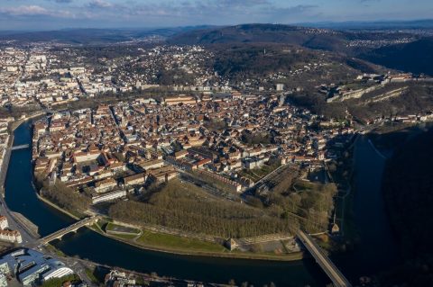
Ce classement porte sur les 563 communes du Doubs. Le tableau est découpé en pages de 100 communes. À l’autre bout du classement, Blarians ferme la marche avec 0,89 km².
Le classement du Doubs : communes les plus étendues
| Rang | Commune | Superficie | Barre proportionnelle | Habitants |
|---|---|---|---|---|
| 1 | Besançon | 65,1 | 121 627 | |
| 2 | Les Premiers Sapins | 52,2 | 1 649 | |
| 3 | Val-d'Usiers | 50,9 | 2 183 | |
| 4 | Pays-de-Montbenoît | 46,5 | 1 964 | |
| 5 | Levier | 44,3 | 2 643 | |
| 6 | Pontarlier | 41,4 | 18 956 | |
| 7 | Étalans | 40,9 | 1 691 | |
| 8 | Chapelle-des-Bois | 39,7 | 274 | |
| 9 | Mouthe | 38,7 | 1 071 | |
| 10 | Ornans | 35,7 | 4 496 | |
| 11 | Éternoz-Vallée-du-Lison | 35,3 | 351 | |
| 12 | Frasne | 32,9 | 2 002 | |
| 13 | Sancey | 30,6 | 1 404 | |
| 14 | Villers-le-Lac | 30,2 | 5 385 | |
| 15 | Vercel-Villedieu-le-Camp | 30,0 | 1 852 | |
| 16 | Jougne | 29,0 | 1 971 | |
| 17 | Pierrefontaine-les-Varans | 28,9 | 1 393 | |
| 18 | Arc-sous-Cicon | 28,5 | 779 | |
| 19 | Chaux-Neuve | 28,3 | 344 | |
| 20 | Boujailles | 28,2 | 468 | |
| 21 | Les Fourgs | 28,0 | 1 472 | |
| 22 | Fournets-Luisans | 27,7 | 764 | |
| 23 | Montlebon | 27,3 | 2 310 | |
| 24 | Valdahon | 25,5 | 5 813 | |
| 25 | Les Fins | 25,4 | 3 143 | |
| 26 | Naisey-les-Granges | 25,1 | 848 | |
| 27 ex æquo | Baume-les-Dames | 24,8 | 5 282 | |
| 27 ex æquo | Orchamps-Vennes | 24,8 | 2 248 | |
| 29 | Bouclans | 24,3 | 1 077 | |
| 30 | Rochejean | 24,3 | 782 | |
| 31 | Anteuil | 24,3 | 616 | |
| 32 | Le Russey | 24,2 | 2 638 | |
| 33 | Tarcenay-Foucherans | 24,0 | 1 531 | |
| 34 | Chapelle-d'Huin | 23,7 | 559 | |
| 35 | Flangebouche | 23,3 | 864 | |
| 36 | Indevillers | 22,8 | 243 | |
| 37 | Pays-de-Clerval | 22,6 | 1 195 | |
| 38 | La Cluse-et-Mijoux | 22,5 | 1 338 | |
| 39 | Villers-sous-Chalamont | 22,2 | 304 | |
| 40 | Labergement-Sainte-Marie | 22,1 | 1 306 | |
| 41 | Damprichard | 21,9 | 1 814 | |
| 42 | Grand'Combe-Châteleu | 21,5 | 1 538 | |
| 43 | Charquemont | 21,4 | 2 947 | |
| 44 | Arçon | 21,3 | 992 | |
| 45 | Fontain | 21,3 | 1 230 | |
| 46 | Châtelblanc | 20,8 | 123 | |
| 47 | Saône | 20,6 | 3 264 | |
| 48 | Laviron | 19,9 | 372 | |
| 49 | Guyans-Vennes | 19,7 | 864 | |
| 50 | Passonfontaine | 19,5 | 339 | |
| 51 | La Rivière-Drugeon | 19,2 | 960 | |
| 52 | Septfontaines | 18,4 | 381 | |
| 53 | Rougemont | 18,3 | 1 058 | |
| 54 | Bouverans | 18,2 | 476 | |
| 55 | Bonnétage | 17,7 | 1 024 | |
| 56 | Les Combes | 17,6 | 798 | |
| 57 | Maîche | 17,4 | 4 361 | |
| 58 | Gonsans | 17,3 | 566 | |
| 59 | Gilley | 17,3 | 1 879 | |
| 60 | La Chaux | 16,9 | 625 | |
| 61 | Chenecey-Buillon | 16,6 | 503 | |
| 62 | Liesle | 16,5 | 562 | |
| 63 | Bonnevaux | 16,5 | 418 | |
| 64 | Nancray | 16,5 | 1 338 | |
| 65 | Saint-Vit | 16,4 | 5 188 | |
| 66 | Marchaux-Chaudefontaine | 16,4 | 1 465 | |
| 67 | Chaffois | 16,3 | 1 057 | |
| 68 | Granges-Narboz | 16,2 | 1 412 | |
| 69 | Belleherbe | 16,1 | 642 | |
| 70 | Myon | 16,1 | 185 | |
| 71 | Glère | 15,9 | 180 | |
| 72 | Ouhans | 15,9 | 412 | |
| 73 | Maisons-du-Bois-Lièvremont | 15,8 | 851 | |
| 74 | Aubonne | 15,2 | 271 | |
| 75 | Remoray-Boujeons | 15,2 | 477 | |
| 76 | Mandeure | 15,1 | 4 746 | |
| 77 | Les Villedieu | 15,1 | 237 | |
| 78 | Montbéliard | 15,0 | 25 159 | |
| 79 | Les Gras | 15,0 | 831 | |
| 80 ex æquo | Arc-et-Senans | 15,0 | 1 649 | |
| 80 ex æquo | Passavant | 15,0 | 196 | |
| 82 | Mathay | 14,9 | 2 162 | |
| 83 | Rurey | 14,8 | 369 | |
| 84 | Cléron | 14,6 | 295 | |
| 85 | Trépot | 14,5 | 576 | |
| 86 | Les Terres-de-Chaux | 14,5 | 139 | |
| 87 | Mamirolle | 14,5 | 2 040 | |
| 88 | Landresse | 14,4 | 244 | |
| 89 | Loray | 14,4 | 639 | |
| 90 | Chantrans | 14,3 | 390 | |
| 91 | Villeneuve-d'Amont | 14,3 | 236 | |
| 92 | Vuillecin | 14,2 | 698 | |
| 93 ex æquo | Les Hôpitaux-Vieux | 14,2 | 476 | |
| 93 ex æquo | Onans | 14,2 | 374 | |
| 95 | Morteau | 14,1 | 7 327 | |
| 96 | Vaire | 14,0 | 822 | |
| 97 | Bulle | 14,0 | 511 | |
| 98 | Vaux-et-Chantegrue | 14,0 | 703 | |
| 99 | Épeugney | 14,0 | 603 | |
| 100 | Soye | 13,9 | 367 |
Source : IGN / Observatoire des territoires (superficies) ; superficie officielle de chaque commune, en km². Rangs ex æquo pour des valeurs égales. Sources des données.