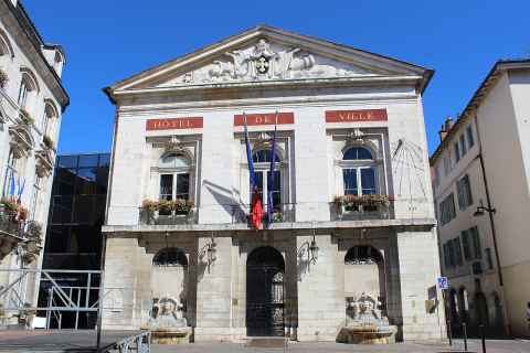

Une intercommunalité (établissement public de coopération intercommunale à fiscalité propre : métropole, communauté urbaine, communauté d'agglomération ou communauté de communes) regroupe des communes qui exercent ensemble certaines compétences et votent une fiscalité commune.
Les 74 communes de la communauté d'agglomération du Bassin de Bourg-en-Bresse par population
| Rang | Commune | Habitants | Barre proportionnelle | Part | km² |
|---|---|---|---|---|---|
| 1 | Bourg-en-Bresse | 43 961 | 31,2 % | 24 | |
| 2 | Viriat | 7 235 | 5,1 % | 45 | |
| 3 | Péronnas | 6 690 | 4,8 % | 18 | |
| 4 | Saint-Denis-lès-Bourg | 6 313 | 4,5 % | 13 | |
| 5 | Attignat | 3 476 | 2,5 % | 19 | |
| 6 | Ceyzériat | 3 412 | 2,4 % | 9,4 | |
| 7 ex æquo | Montrevel-en-Bresse | 2 790 | 2,0 % | 10 | |
| 7 ex æquo | Polliat | 2 790 | 2,0 % | 20 | |
| 9 | Saint-Étienne-du-Bois | 2 634 | 1,9 % | 28 | |
| 10 | Val-Revermont | 2 539 | 1,8 % | 45 | |
| 11 | Bresse Vallons | 2 427 | 1,7 % | 26 | |
| 12 | Marboz | 2 307 | 1,6 % | 40 | |
| 13 | Montagnat | 2 232 | 1,6 % | 14 | |
| 14 | Foissiat | 2 066 | 1,5 % | 40 | |
| 15 | Saint-Martin-du-Mont | 2 055 | 1,5 % | 28 | |
| 16 | Jasseron | 1 958 | 1,4 % | 19 | |
| 17 | Buellas | 1 946 | 1,4 % | 10 | |
| 18 | Certines | 1 570 | 1,1 % | 16 | |
| 19 | Lent | 1 547 | 1,1 % | 31 | |
| 20 | Meillonnas | 1 472 | 1,0 % | 18 | |
| 21 | Tossiat | 1 453 | 1,0 % | 10 | |
| 22 | Villereversure | 1 447 | 1,0 % | 17 | |
| 23 | Confrançon | 1 387 | 1,0 % | 18 | |
| 24 | Coligny | 1 375 | 1,0 % | 17 | |
| 25 | Servas | 1 313 | 0,9 % | 13 | |
| 26 | Malafretaz | 1 285 | 0,9 % | 9,2 | |
| 27 | Jayat | 1 283 | 0,9 % | 16 | |
| 28 | Dompierre-sur-Veyle | 1 266 | 0,9 % | 29 | |
| 29 | Saint-André-sur-Vieux-Jonc | 1 255 | 0,9 % | 24 | |
| 30 | Druillat | 1 159 | 0,8 % | 21 | |
| 31 | Saint-Trivier-de-Courtes | 1 135 | 0,8 % | 17 | |
| 32 | Marsonnas | 1 059 | 0,8 % | 18 | |
| 33 | Montracol | 1 056 | 0,8 % | 15 | |
| 34 | Saint-Just | 975 | 0,7 % | 3,4 | |
| 35 | Bohas-Meyriat-Rignat | 963 | 0,7 % | 24 | |
| 36 | Revonnas | 948 | 0,7 % | 7,8 | |
| 37 | Saint-Rémy | 934 | 0,7 % | 7,4 | |
| 38 | Saint-Didier-d'Aussiat | 862 | 0,6 % | 15 | |
| 39 | Curtafond | 843 | 0,6 % | 12 | |
| 40 | Nivigne et Suran | 838 | 0,6 % | 31 | |
| 41 | Saint-Martin-le-Châtel | 819 | 0,6 % | 13 | |
| 42 | Bény | 794 | 0,6 % | 18 | |
| 43 | Hautecourt-Romanèche | 776 | 0,6 % | 22 | |
| 44 | Saint-Jean-sur-Reyssouze | 774 | 0,6 % | 27 | |
| 45 | Vandeins | 746 | 0,5 % | 9,4 | |
| 46 | Beaupont | 745 | 0,5 % | 14 | |
| 47 | Lescheroux | 734 | 0,5 % | 20 | |
| 48 | Montcet | 726 | 0,5 % | 6,7 | |
| 49 | Cormoz | 708 | 0,5 % | 20 | |
| 50 ex æquo | Saint-Julien-sur-Reyssouze | 688 | 0,5 % | 7,5 | |
| 50 ex æquo | Simandre-sur-Suran | 688 | 0,5 % | 16 | |
| 52 | Villemotier | 630 | 0,4 % | 14 | |
| 53 | Corveissiat | 618 | 0,4 % | 23 | |
| 54 | Saint-Nizier-le-Bouchoux | 591 | 0,4 % | 28 | |
| 55 | Domsure | 560 | 0,4 % | 15 | |
| 56 | Courmangoux | 536 | 0,4 % | 15 | |
| 57 | Béréziat | 486 | 0,3 % | 11 | |
| 58 | Curciat-Dongalon | 484 | 0,3 % | 24 | |
| 59 | Pirajoux | 407 | 0,3 % | 13 | |
| 60 | Journans | 395 | 0,3 % | 2,4 | |
| 61 | Verjon | 352 | 0,3 % | 5,1 | |
| 62 | Ramasse | 342 | 0,2 % | 9,9 | |
| 63 | Mantenay-Montlin | 339 | 0,2 % | 11 | |
| 64 | Salavre | 313 | 0,2 % | 7,8 | |
| 65 | La Tranclière | 296 | 0,2 % | 15 | |
| 66 ex æquo | Courtes | 293 | 0,2 % | 9,1 | |
| 66 ex æquo | Vernoux | 293 | 0,2 % | 10 | |
| 68 | Saint-Sulpice | 263 | 0,2 % | 5,3 | |
| 69 | Vescours | 223 | 0,2 % | 12 | |
| 70 | Drom | 219 | 0,2 % | 7,8 | |
| 71 ex æquo | Grand-Corent | 188 | 0,1 % | 7,1 | |
| 71 ex æquo | Servignat | 188 | 0,1 % | 8,0 | |
| 73 | Cize | 175 | 0,1 % | 4,5 | |
| 74 | Pouillat | 80 | 0,1 % | 6,2 |
Bourg-en-Bresse : commune, agglomération, aire d’attraction, intercommunalité
| Périmètre | Communes | Habitants |
|---|---|---|
| Commune de Bourg-en-Bresse | 1 | 43 961 |
| Unité urbaine de Bourg-en-Bresse | 5 | 65 174 |
| Aire d’attraction de Bourg-en-Bresse | 80 | 149 067 |
| Communauté d'agglomération du Bassin de Bourg-en-Bresse | 74 | 140 725 |
Source : Insee, table d’appartenance géographique des communes (zonages en vigueur) et populations légales (population totale). Sources des données.