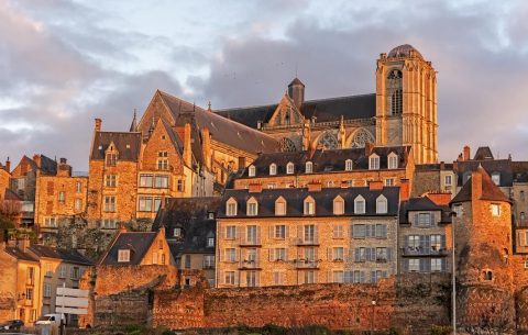
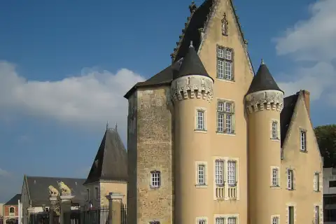
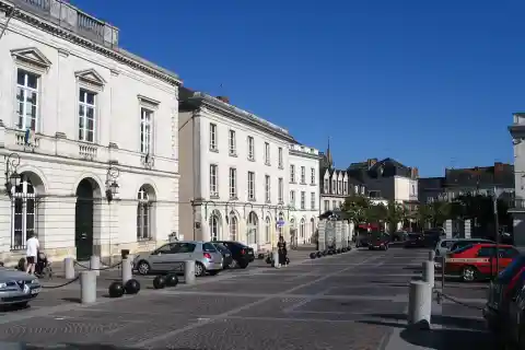
The largest city in the Sarthe department is Le Mans, with 148,876 inhabitants (ranked 24th in France by population). The largest town by area is Villeneuve-en-Perseigne (87 km²). Le Mans is also the most densely populated town, with 2,819 inhabitants per km². At the other end of the ranking, Nauvay has only 12 inhabitants.
The Sarthe department has 579,227 inhabitants over 6,206 km², a density of 93 inhabitants per km², close to the national average (110 per km²). It accounts for 14.5% of the population of Pays de la Loire, the region it belongs to: see the ranking of the largest cities in Pays de la Loire.
The 20 largest cities in the Sarthe department by population
| Rank | Town | Population | km² | per km² | Proportional bar | France rank |
|---|---|---|---|---|---|---|
| 1 | Le Mans | 148,876 | 53 | 2,819 | 24th | |
| 2 | La Flèche | 15,884 | 74 | 214 | 636th | |
| 3 | Sablé-sur-Sarthe | 12,850 | 37 | 348 | 795th | |
| 4 | Allonnes | 10,846 | 18 | 600 | 969th | |
| 5 | La Ferté-Bernard | 8,981 | 15 | 600 | 1,206th | |
| 6 | Coulaines | 8,226 | 3.9 | 2,093 | 1,338th | |
| 7 | Changé | 7,070 | 35 | 202 | 1,573rd | |
| 8 | Montval-sur-Loir | 5,827 | 27 | 216 | 1,980th | |
| 9 | Arnage | 5,548 | 11 | 516 | 2,078th | |
| 10 | Parigné-l'Évêque | 5,454 | 63 | 86 | 2,114th | |
| 11 | Mulsanne | 5,352 | 15 | 351 | 2,146th | |
| 12 | Mamers | 5,150 | 5.1 | 1,020 | 2,235th | |
| 13 | Écommoy | 4,957 | 29 | 174 | 2,318th | |
| 14 | La Suze-sur-Sarthe | 4,747 | 21 | 222 | 2,431st | |
| 15 | Laigné-Saint-Gervais | 4,337 | 22 | 195 | 2,664th | |
| 16 | Yvré-l'Évêque | 4,269 | 28 | 155 | 2,706th | |
| 17 | Savigné-l'Évêque | 4,102 | 28 | 144 | 2,822nd | |
| 18 | Le Lude | 4,036 | 68 | 59 | 2,880th | |
| 19 | Sargé-lès-le-Mans | 3,941 | 14 | 285 | 2,948th | |
| 20 | La Bazoge | 3,878 | 23 | 170 | 3,003rd |
Largest towns by area in the Sarthe department
| Rank | Town | Population | km² | per km² | Proportional bar | France rank |
|---|---|---|---|---|---|---|
| 1 | Villeneuve-en-Perseigne | 2,210 | 87 | 25 | 333rd | |
| 2 | La Flèche | 15,884 | 74 | 214 | 470th | |
| 3 | Le Lude | 4,036 | 68 | 59 | 569th | |
| 4 | Loir en Vallée | 2,115 | 65 | 33 | 657th | |
| 5 | Parigné-l'Évêque | 5,454 | 63 | 86 | 684th | |
| 6 | Précigné | 3,016 | 58 | 52 | 834th | |
| 7 | Mayet | 3,231 | 54 | 60 | 966th | |
| 8 | Le Mans | 148,876 | 53 | 2,819 | 1,031st | |
| 9 | Luché-Pringé | 1,563 | 49 | 32 | 1,219th | |
| 10 | Auvers-le-Hamon | 1,466 | 48 | 31 | 1,314th |
Most densely populated towns in the Sarthe department
| Rank | Town | Population | km² | per km² | Proportional bar | France rank |
|---|---|---|---|---|---|---|
| 1 | Le Mans | 148,876 | 53 | 2,819 | 319th | |
| 2 | Coulaines | 8,226 | 3.9 | 2,093 | 433rd | |
| 3 | Mamers | 5,150 | 5.1 | 1,020 | 929th | |
| 4 | Bourg-le-Roi | 335 | 0.4 | 931 | 1,020th | |
| 5 | La Ferté-Bernard | 8,981 | 15 | 600 | 1,566th | |
| 6 | Allonnes | 10,846 | 18 | 600 | 1,568th | |
| 7 | Arnage | 5,548 | 11 | 516 | 1,812th | |
| 8 | Saint-Pavace | 2,055 | 5.2 | 398 | 2,287th | |
| 9 | La Chapelle-Saint-Aubin | 2,319 | 5.9 | 391 | 2,319th | |
| 10 | Mulsanne | 5,352 | 15 | 351 | 2,584th |
Sarthe in figures
Official data compared with the Pays de la Loire region and France.
Population since 1968
Municipal population at the latest census: 566,733, −0.4% over ten years and +23% since 1968 (France: +34%).
Compared growth
Index 100 in 1968
Municipal population at each census, current municipal boundaries; France excluding Mayotte. Source: INSEE, population censuses
Age of residents
People aged 65 and over make up 23.4% of the population (France: 21.2%), under-15s 17.1%.
| Sarthe | Region | France | |
|---|---|---|---|
| Under 15 | 17.1% | 17.4% | 17.0% |
| 15–24 | 11.7% | 12.0% | 11.9% |
| 25–39 | 15.9% | 17.0% | 17.9% |
| 40–54 | 18.8% | 19.3% | 19.2% |
| 55–64 | 13.1% | 12.4% | 12.7% |
| 65–79 | 16.3% | 15.5% | 15.1% |
| 80 and over | 7.1% | 6.4% | 6.1% |
Town shares weighted by municipal population; France excluding Mayotte. Source: INSEE, population census
Housing
About 299,610 dwellings, 4.8% of them second homes (France: 9.7%).
| Sarthe | Region | France | |
|---|---|---|---|
| Main residences | 86.6% | 83.4% | 82.4% |
| Second homes | 4.8% | 10.4% | 9.7% |
| Vacant dwellings | 8.6% | 6.2% | 7.8% |
| Houses | 74.7% | 70.2% | 54.7% |
| Apartments | 24.1% | 28.8% | 44.3% |
| Owner-occupiers | 64.7% | 64.0% | 57.5% |
| Tenants | 34.1% | 34.9% | 40.3% |
| of which social housing | 13.6% | 12.1% | 14.6% |
Towns in Pays de la Loire with the highest share of second homesTowns in Pays de la Loire with the highest share of social housing
Shares of all dwellings (tenure: shares of main residences). Source: INSEE, population census
Property prices
Apartments sell for a median €1,814 per m², 46% below the national median.
| Sarthe | France | |
|---|---|---|
| Apartment | €1,814 | €3,374 |
| House | €1,579 | €2,143 |
Across the region, the median price of apartments ranges from €1,814 (Sarthe) to €3,463 (Loire-Atlantique) per m²; no regional median is published.
Most expensive cities in Pays de la LoireTowns in Pays de la Loire where houses are most expensive
Median price per m² of apartment and house sales over the last five years; France excluding Alsace-Moselle and Mayotte. Source: DGFiP, land value requests (DVF)
Income
Half of the residents have a standard of living above €24,990 a year (disposable income per consumption unit).
| Sarthe | Region | Metro. France | |
|---|---|---|---|
| Median standard of living | €24,990 | €26,040 | €25,920 |
| Poverty rate | 14.1% | 11.5% | 15.9% |
Richest towns in Pays de la LoireRichest cities in Pays de la Loire
Values published by INSEE for each area. Source: INSEE, Filosofi
Employment
| Sarthe | Region | France | |
|---|---|---|---|
| Unemployment rate | 10.4% | 9.1% | 11.4% |
| Activity rate | 76.1% | 77.6% | 75.6% |
Towns in Pays de la Loire with the highest unemployment rate
Unemployment as reported in the census, which differs from the quarterly ILO rate. Source: INSEE, population census
Recorded crime
Offences recorded by the police and gendarmerie over one year, per 1,000 inhabitants (* per 1,000 dwellings).
| Sarthe | Region | France | |
|---|---|---|---|
| Physical violence outside the family | 2.8 | 2.3 | 3.2 |
| Domestic physical violence | 4.0 | 3.3 | 3.8 |
| Sexual violence | 2.6 | 2.1 | 1.9 |
| Non-violent theft from persons | 5.2 | 6.2 | 9.1 |
| Residential burglaries* | 6.8 | 5.3 | 5.6 |
| Vehicle thefts | 1.3 | 1.6 | 1.8 |
| Criminal damage | 6.4 | 6.6 | 7.9 |
| Fraud | 5.6 | 5.9 | 6.5 |
Towns in Pays de la Loire with the highest recorded burglary rateTowns in Pays de la Loire with the highest recorded rate of physical violence outside the family
Values published for each area; they do not measure all crime (reporting, police activity). Source: Ministry of the Interior, SSMSI
Health
| Sarthe | Region | France | |
|---|---|---|---|
| Access to general practitionersconsultations per year per inhabitant | 2.7 | 3.5 | 3.7 |
| Access to dentistsFTE per 100,000 inhabitants | 36 | 53 | 62 |
| Access to nursesFTE per 100,000 inhabitants | 80 | 83 | 154 |
| Access to physiotherapistsFTE per 100,000 inhabitants | 68 | 98 | 124 |
| General practitionersper 10,000 inhabitants | 6.0 | 8.4 | 9.0 |
| Pharmaciesper 10,000 inhabitants | 2.6 | 2.7 | 3.0 |
| Hospital sitesper 100,000 inhabitants | 6.5 | 6.9 | 7.8 |
Medical deserts: the towns in Pays de la Loire with the poorest access to general practitioners
Accessibility: average of towns weighted by population; France excluding Mayotte. Sources: DREES, localized potential accessibility, INSEE, BPE, FINESS
Shops and facilities
19,548 facilities and services listed, 345 per 10,000 inhabitants (France: 427).
| Per 10,000 inhabitants | ||||
|---|---|---|---|---|
| Number | Sarthe | Region | France | |
| Supermarkets | 129 | 2.3 | 1.9 | 2.2 |
| Bakeries | 399 | 7.0 | 6.5 | 7.3 |
| Restaurants | 1,029 | 18.2 | 22.9 | 33.9 |
| Hotels | 100 | 1.8 | 1.8 | 2.5 |
| Post offices | 213 | 3.8 | 2.7 | 2.5 |
| Passenger stations | 28 | 0.5 | 0.3 | 0.4 |
| Sports facilities | 2,700 | 47.6 | 33.6 | 27.8 |
| Cultural venues | 188 | 3.3 | 3.5 | 3.4 |
Schools
| Private share | |||
|---|---|---|---|
| Sarthe | Region | France | |
| Primary schools465 open | 14% | 32% | 12% |
| Lower secondary schools94 open | 26% | 40% | 25% |
| Upper secondary schools49 open | 47% | 54% | 39% |
Climate
Across its 11 weather stations, the mean annual temperature ranges from 10.8 °C (Villeneuve-en-Perseigne – La Fresnaye, 146 m) to 12.4 °C (Luché-Pringé, 92 m).
| Sarthe | Region | Metro. France | |
|---|---|---|---|
| Mean temperature | 10.8–12.4 °C | 10.8–13.4 °C | 2.8–17.5 °C |
| Precipitation | 658–807 mm | 595–959 mm | 474–2,282 mm |
| Sunshine | 1,809 hLe Mans, 51 m | 1,809–2,324 h | 1,463–2,898 h |
| Days at 30 °C or more | 7–23 d | 5–23 d | 0–81 d |
| Frost days | 29–62 d | 10–62 d | 0–204 d |
Sunniest cities in Pays de la LoireSunniest large cities in Pays de la Loire
Thirty-year normals of the stations in the area, without interpolation. Source: Météo-France, climate normals
Natural disasters
2,063 recognitions of a state of natural disaster since 1982 in its towns, the latest for an event on October 9, 2024.
| Per town, on average | |||
|---|---|---|---|
| Sarthe | Region | France | |
| All recognitions | 5.9 | 7.5 | 7.1 |
| Floods and mudslides | 3.4 | 4.5 | 4.2 |
| Drought (clay shrinkage) | 1.1 | 1.2 | 1.2 |
| Ground movements | 1.3 | 1.5 | 1.0 |
| Storms, hail, snow | 0.0 | 0.3 | 0.6 |
| Earthquakes | 0.0 | 0.0 | 0.0 |
Towns in Pays de la Loire with the most officially recognized natural disasters
One recognition per town, event and hazard. Source: Géorisques, GASPAR database
Towns by size
| Share of towns | ||||
|---|---|---|---|---|
| Towns | Sarthe | Region | France | |
| Under 500 | 130 | 36.9% | 22.8% | 51.7% |
| 500–1,999 | 161 | 45.7% | 42.3% | 32.2% |
| 2,000–4,999 | 49 | 13.9% | 22.3% | 9.5% |
| 5,000–9,999 | 8 | 2.3% | 8.1% | 3.5% |
| 10,000–49,999 | 3 | 0.9% | 3.7% | 2.7% |
| 50,000 and over | 1 | 0.3% | 0.7% | 0.4% |
Sources: INSEE, official populations, INSEE, official geographic code
Political label of mayors’ lists
Political label assigned by the Ministry of the Interior to the list of the mayor elected in March 2026, in the 23 towns where one is assigned (3,500 inhabitants or more, and sub-prefectures).
| Share of towns | ||||
|---|---|---|---|---|
| Towns | Sarthe | Region | France | |
| Miscellaneous (Divers) LDIV | 8 | 35% | 29% | 17% |
| Miscellaneous right (Divers droite) LDVD | 6 | 26% | 30% | 34% |
| Socialist Party (Parti socialiste) LSOC | 3 | 13% | 1% | 1% |
| Miscellaneous center (Divers centre) LDVC | 2 | 9% | 22% | 17% |
| French Communist Party (Parti communiste français) LCOM | 1 | 4% | 0% | 1% |
| Miscellaneous left (Divers gauche) LDVG | 1 | 4% | 14% | 18% |
| Democratic Movement (MoDem) LMDM | 1 | 4% | 0% | 0% |
| National Rally (Rassemblement national) LRN | 1 | 4% | 0% | 1% |
The label is assigned by the ministry and may differ from the one chosen by the candidates. Sources: Ministry of the Interior, 2026 municipal elections, National register of elected officials
Town finances
Main budget of the towns for the latest fiscal year published, in euros per inhabitant.
| Sarthe | Region | France | |
|---|---|---|---|
| Debtoutstanding on December 31 | €578 | €725 | €993 |
| Local taxes | €437 | €598 | €639 |
| Capital spending | €322 | €455 | €463 |
Most indebted towns in Pays de la LoireMost indebted cities in Pays de la Loire
Total of the towns’ amounts divided by their total DGF population; intercommunalities not included. Source: DGFiP (French public finance directorate), individual accounts of communes
Tourism
93 hotels and 41 campgrounds, with 6,363 rooms and campsites in all: 1.1 per 100 inhabitants (France: 2.2).
| Per 10,000 inhabitants | ||||
|---|---|---|---|---|
| Number | Sarthe | Region | France | |
| Hotels | 93 | 1.6 | 1.6 | 2.3 |
| Hotel rooms | 3,322 | 57.4 | 61.9 | 94.9 |
| Campgrounds | 41 | 0.7 | 1.4 | 1.1 |
| Campsites | 3,041 | 52.5 | 197.7 | 121.9 |
Most touristic towns in Pays de la LoireTowns in Pays de la Loire with the most hotel rooms and campsites
Establishments open on January 1, rated or not. Source: INSEE, tourist accommodation capacity of communes
Vacant homes
15,350 vacant homes in the private housing stock of the towns whose figures are published.
| Sarthe | Region | France | |
|---|---|---|---|
| Vacant homes | 6.9% | 5.1% | 7.1% |
| Vacant for more than two years | 3.8% | 2.5% | 3.9% |
Towns in Pays de la Loire with the highest housing vacancy rate
Towns whose figures are published (tax confidentiality covers those with fewer than 11 vacant homes); all vacancy on January 1, including short spells. Source: Ministry of Housing and Cerema, LOVAC
Historic monuments
| Sarthe | Region | France | |
|---|---|---|---|
| Historic monuments | 437 | 2,171 | 46,704 |
| of which classified | 118 | 677 | 14,964 |
| Per 10,000 inhabitants | 7.5 | 5.4 | 6.7 |
| Towns with at least one | 57% | 59% | 47% |
Towns in Pays de la Loire with the most historic monuments
Classified or registered buildings; a monument that spans several towns counts only once. Source: Ministry of Culture, Mérimée database
Train stations
28 passenger stations, which together handle 7,472,673 passengers a year. The busiest: Le Mans (5,440,432), Sablé-sur-Sarthe (662,172), La Ferté-Bernard (297,050).
Busiest train stations in Pays de la Loire
Source: SNCF Gares & Connexions. SNCF data, ODbL license.
Elections
In the second round of the 2022 presidential election, Emmanuel Macron came first in Sarthe with 55.4% of the valid votes in its towns (France: Emmanuel Macron, 58.1%).
| Turnout | |||
|---|---|---|---|
| Sarthe | Region | France | |
| 2022 presidential, 1st round | 74.4% | 77.0% | 75.3% |
| 2022 presidential, 2nd round | 74.8% | 76.4% | 73.3% |
| 2024 legislative, 1st round | 66.6% | 69.9% | 67.9% |
| 2024 European | 50.6% | 53.2% | 53.0% |
Towns in Pays de la Loire with the highest turnout in the second round of the 2022 presidential electionTowns in Pays de la Loire with the highest turnout in the 2024 European elections
Voters as a share of registered voters, with votes added up across the area’s towns; France: excluding French citizens voting abroad. Source: Ministry of the Interior, election results
All towns in the Sarthe department (352)
INSEE total population in parentheses. Each town page gives its area, density, national and departmental rankings, and neighboring towns.
- Aigné (1,724)
- Aillières-Beauvoir (205)
- Allonnes (10,846)
- Amné (576)
- Ancinnes (917)
- Arçonnay (2,142)
- Ardenay-sur-Mérize (516)
- Arnage (5,548)
- Arthezé (366)
- Asnières-sur-Vègre (340)
- Assé-le-Boisne (910)
- Assé-le-Riboul (484)
- Aubigné-Racan (2,177)
- Auvers-le-Hamon (1,466)
- Auvers-sous-Montfaucon (236)
- Avesnes-en-Saosnois (93)
- Avessé (340)
- Avezé (714)
- Avoise (603)
- Ballon-Saint Mars (2,300)
- Bazouges Cré sur Loir (2,034)
- Beaufay (1,545)
- Beaumont-Pied-de-Bœuf (480)
- Beaumont-sur-Dême (330)
- Beaumont-sur-Sarthe (1,989)
- Beillé (545)
- Berfay (340)
- Bernay-Neuvy-en-Champagne (842)
- Bérus (444)
- Bessé-sur-Braye (2,018)
- Béthon (331)
- Blèves (128)
- Boëssé-le-Sec (517)
- Bonnétable (3,755)
- Bouër (356)
- Bouloire (2,154)
- Bourg-le-Roi (335)
- Bousse (434)
- Brains-sur-Gée (766)
- Brette-les-Pins (2,269)
- Briosne-lès-Sables (566)
- Brûlon (1,575)
- Cérans-Foulletourte (3,390)
- Chahaignes (673)
- Challes (1,178)
- Champagné (3,728)
- Champfleur (1,309)
- Champrond (70)
- Changé (7,070)
- Chantenay-Villedieu (824)
- Chassillé (256)
- Château-l'Hermitage (261)
- Chaufour-Notre-Dame (1,187)
- Chemiré-en-Charnie (219)
- Chemiré-le-Gaudin (1,016)
- Chenay (260)
- Chenu (427)
- Chérancé (357)
- Chérisay (313)
- Cherré-Au (2,821)
- Chevillé (361)
- Clermont-Créans (1,321)
- Cogners (174)
- Commerveil (143)
- Conflans-sur-Anille (475)
- Congé-sur-Orne (325)
- Conlie (1,860)
- Connerré (2,818)
- Contilly (138)
- Cormes (911)
- Coudrecieux (647)
- Coulaines (8,226)
- Coulans-sur-Gée (1,679)
- Coulongé (521)
- Courcebœufs (645)
- Courcelles-la-Forêt (404)
- Courcemont (675)
- Courcival (82)
- Courdemanche (634)
- Courgains (595)
- Courgenard (464)
- Courtillers (924)
- Crannes-en-Champagne (347)
- Crissé (546)
- Crosmières (995)
- Cures (505)
- Dangeul (491)
- Degré (764)
- Dehault (244)
- Dissay-sous-Courcillon (980)
- Dollon (1,446)
- Domfront-en-Champagne (1,087)
- Doucelles (227)
- Douillet (324)
- Duneau (1,095)
- Dureil (62)
- Écommoy (4,957)
- Écorpain (306)
- Épineu-le-Chevreuil (292)
- Étival-lès-le-Mans (1,860)
- Fatines (937)
- Fay (770)
- Fercé-sur-Sarthe (586)
- Fillé (1,590)
- Flée (538)
- Fontenay-sur-Vègre (314)
- Fresnay-sur-Sarthe (2,969)
- Fyé (1,051)
- Gesnes-le-Gandelin (913)
- Grandchamp (142)
- Gréez-sur-Roc (347)
- Guécélard (3,240)
- Jauzé (82)
- Joué-en-Charnie (596)
- Joué-l'Abbé (1,290)
- Juigné-sur-Sarthe (1,170)
- Juillé (416)
- Jupilles (579)
- La Bazoge (3,878)
- La Bosse (157)
- La Bruère-sur-Loir (251)
- La Chapelle-aux-Choux (285)
- La Chapelle-d'Aligné (1,757)
- La Chapelle-du-Bois (785)
- La Chapelle-Huon (524)
- La Chapelle-Saint-Aubin (2,319)
- La Chapelle-Saint-Fray (428)
- La Chapelle-Saint-Rémy (1,001)
- La Chartre-sur-le-Loir (1,388)
- La Ferté-Bernard (8,981)
- La Flèche (15,884)
- La Fontaine-Saint-Martin (605)
- La Guierche (1,325)
- La Milesse (2,650)
- La Quinte (837)
- La Suze-sur-Sarthe (4,747)
- Laigné-Saint-Gervais (4,337)
- Lamnay (955)
- Lavardin (706)
- Lavaré (827)
- Lavernat (598)
- Le Bailleul (1,243)
- Le Breil-sur-Mérize (1,583)
- Le Grand-Lucé (1,969)
- Le Grez (385)
- Le Luart (1,480)
- Le Lude (4,036)
- Le Mans (148,876)
- Le Tronchet (173)
- Les Aulneaux (112)
- Les Mées (106)
- Lhomme (944)
- Ligron (508)
- Livet-en-Saosnois (66)
- Loir en Vallée (2,115)
- Lombron (1,983)
- Longnes (288)
- Louailles (708)
- Loué (2,188)
- Louplande (1,539)
- Louvigny (182)
- Louzes (106)
- Lucé-sous-Ballon (109)
- Luceau (1,251)
- Luché-Pringé (1,563)
- Maigné (328)
- Maisoncelles (204)
- Malicorne-sur-Sarthe (1,892)
- Mamers (5,150)
- Mansigné (1,574)
- Marçon (1,079)
- Mareil-en-Champagne (347)
- Mareil-sur-Loir (657)
- Maresché (890)
- Marigné-Laillé (1,687)
- Marolles-les-Braults (2,061)
- Marolles-lès-Saint-Calais (294)
- Marollette (161)
- Mayet (3,231)
- Melleray (467)
- Meurcé (277)
- Mézeray (1,867)
- Mézières-sous-Lavardin (687)
- Mézières-sur-Ponthouin (734)
- Moitron-sur-Sarthe (262)
- Moncé-en-Belin (3,753)
- Moncé-en-Saosnois (225)
- Monhoudou (222)
- Mont-Saint-Jean (636)
- Montaillé (522)
- Montbizot (1,869)
- Montfort-le-Gesnois (2,972)
- Montmirail (368)
- Montreuil-le-Chétif (324)
- Montreuil-le-Henri (303)
- Montval-sur-Loir (5,827)
- Moulins-le-Carbonnel (708)
- Mulsanne (5,352)
- Nauvay (12)
- Neufchâtel-en-Saosnois (1,021)
- Neuvillalais (600)
- Neuville-sur-Sarthe (2,495)
- Neuvillette-en-Charnie (310)
- Nogent-le-Bernard (879)
- Nogent-sur-Loir (365)
- Notre-Dame-du-Pé (723)
- Nouans (252)
- Noyen-sur-Sarthe (2,603)
- Nuillé-le-Jalais (531)
- Oisseau-le-Petit (679)
- Oizé (1,341)
- Panon (33)
- Parcé-sur-Sarthe (2,004)
- Parennes (457)
- Parigné-l'Évêque (5,454)
- Parigné-le-Pôlin (1,057)
- Peray (70)
- Pezé-le-Robert (348)
- Piacé (376)
- Pincé (196)
- Pirmil (524)
- Pizieux (76)
- Poillé-sur-Vègre (597)
- Pontvallain (1,630)
- Précigné (3,016)
- Préval (670)
- Prévelles (195)
- Pruillé-l'Éguillé (812)
- Pruillé-le-Chétif (1,357)
- Rahay (171)
- René (392)
- Requeil (1,131)
- Roëzé-sur-Sarthe (2,572)
- Rouessé-Fontaine (267)
- Rouessé-Vassé (795)
- Rouez (819)
- Rouillon (2,666)
- Rouperroux-le-Coquet (269)
- Ruaudin (3,542)
- Ruillé-en-Champagne (317)
- Sablé-sur-Sarthe (12,850)
- Saint-Aignan (265)
- Saint-Aubin-de-Locquenay (779)
- Saint-Aubin-des-Coudrais (903)
- Saint-Biez-en-Belin (720)
- Saint-Calais (3,146)
- Saint-Calez-en-Saosnois (180)
- Saint-Célerin (889)
- Saint-Christophe-du-Jambet (235)
- Saint-Christophe-en-Champagne (225)
- Saint-Corneille (1,530)
- Saint-Cosme-en-Vairais (1,965)
- Saint-Denis-d'Orques (771)
- Saint-Denis-des-Coudrais (114)
- Saint-Georges-de-la-Couée (183)
- Saint-Georges-du-Bois (2,308)
- Saint-Georges-du-Rosay (459)
- Saint-Georges-le-Gaultier (525)
- Saint-Germain-d'Arcé (346)
- Saint-Gervais-de-Vic (388)
- Saint-Jean-d'Assé (1,823)
- Saint-Jean-de-la-Motte (969)
- Saint-Jean-des-Échelles (227)
- Saint-Jean-du-Bois (626)
- Saint-Léonard-des-Bois (482)
- Saint-Longis (514)
- Saint-Maixent (762)
- Saint-Marceau (542)
- Saint-Mars-d'Outillé (2,517)
- Saint-Mars-la-Brière (2,715)
- Saint-Martin-des-Monts (182)
- Saint-Michel-de-Chavaignes (753)
- Saint-Ouen-de-Mimbré (926)
- Saint-Ouen-en-Belin (1,337)
- Saint-Ouen-en-Champagne (243)
- Saint-Paterne - Le Chevain (2,336)
- Saint-Paul-le-Gaultier (290)
- Saint-Pavace (2,055)
- Saint-Pierre-de-Chevillé (341)
- Saint-Pierre-des-Bois (225)
- Saint-Pierre-des-Ormes (211)
- Saint-Pierre-du-Lorouër (363)
- Saint-Rémy-de-Sillé (841)
- Saint-Rémy-des-Monts (726)
- Saint-Rémy-du-Val (505)
- Saint-Saturnin (2,864)
- Saint-Symphorien (521)
- Saint-Ulphace (224)
- Saint-Victeur (439)
- Saint-Vincent-des-Prés (516)
- Saint-Vincent-du-Lorouër (829)
- Sainte-Cérotte (346)
- Sainte-Jamme-sur-Sarthe (1,973)
- Sainte-Sabine-sur-Longève (753)
- Saosnes (219)
- Sarcé (273)
- Sargé-lès-le-Mans (3,941)
- Savigné-l'Évêque (4,102)
- Savigné-sous-le-Lude (454)
- Sceaux-sur-Huisne (597)
- Ségrie (601)
- Semur-en-Vallon (438)
- Sillé-le-Guillaume (2,276)
- Sillé-le-Philippe (1,102)
- Solesmes (1,266)
- Sougé-le-Ganelon (851)
- Souillé (812)
- Souligné-Flacé (647)
- Souligné-sous-Ballon (1,262)
- Soulitré (611)
- Souvigné-sur-Même (170)
- Souvigné-sur-Sarthe (616)
- Spay (2,876)
- Surfonds (345)
- Tassé (296)
- Tassillé (139)
- Teillé (546)
- Teloché (3,126)
- Tennie (1,016)
- Terrehault (139)
- Théligny (221)
- Thoigné (166)
- Thoiré-sous-Contensor (112)
- Thoiré-sur-Dinan (406)
- Thorée-les-Pins (749)
- Thorigné-sur-Dué (1,721)
- Torcé-en-Vallée (1,427)
- Trangé (1,678)
- Tresson (523)
- Tuffé Val de la Chéronne (1,693)
- Vaas (1,396)
- Val-d'Étangson (538)
- Val-de-la-Hune (1,550)
- Valennes (305)
- Vallon-sur-Gée (784)
- Vancé (285)
- Verneil-le-Chétif (637)
- Vernie (350)
- Vezot (75)
- Vibraye (2,558)
- Villaines-la-Carelle (133)
- Villaines-la-Gonais (520)
- Villaines-sous-Lucé (671)
- Villaines-sous-Malicorne (1,045)
- Villeneuve-en-Perseigne (2,210)
- Vion (1,393)
- Viré-en-Champagne (209)
- Vivoin (902)
- Voivres-lès-le-Mans (1,365)
- Vouvray-sur-Huisne (135)
- Yvré-l'Évêque (4,269)
- Yvré-le-Pôlin (1,736)
Sources: INSEE, official population figures in force on January 1, 2026 (total population); land area: IGN / Observatoire des territoires. Rankings computed across the 34,875 communes in the database.